Saturday, August 31, 2019

Thames (NZ): The Kauaeranga from Parawai - Then & Now

Its always nice to see a 'new' postcard not seen before (by me at least!). The usual views out over the Kauaeranga River and Parawai are taken from Mount Sea Road, but this one is south near where Herewaka Street is today.


 ]
ABOVE: Left, the view from the intersection of Herewaka Street and Parawai Road.
 Right, further north along Parawai Road.
BELOW: This old postcard below, looks back towards Parawai Road and where the old two-storey house was located (centre right).

The Kauaeranga River from the bridge:
View from The Kauaeranga Bridge looking east.
Source: Then & Now 150 Years by A Barker

Thursday, August 29, 2019

Thames (NZ): Did your Thamesites get a mention in the Police Gazette?

Thanks to Tom for the alert on the online availability of the New Zealand Police Gazettes.

The New Zealand Police Gazette 1877 to 1945 is available at Papers Past, thanks to the National Library of New Zealand, Te Puna Matauranga O Aotearoa.
"Like its predecessors, the New Zealand Police Gazette was a working tool for the police. It contained descriptions of crimes, wanted offenders, missing people, deserters, stolen items, and lost and found property, as well as notices about police appointments or promotions. It also published reports of discharged prisoners which, as well as listing the prisoner’s name, offence, date and place of trial, and sentence, included information about their occupation, height, eye and hair colour. From 1905 until 1917, relevant law reports were also included – after that the law reports were published as a separate title."

Criminal Events at The Thames:

The reports and notices are numerous regarding criminal investigations and convictions on the goldfield. The stealing of specimens one of the most common. In 1877, from a mine on the Moanataiari Spur 14lbs of quartz specimens were stolen. They belonged to the mining party led by John Brett. The report below named Richard Owsley as the one under suspicion for the robbery.

NEW ZEALAND POLICE GAZETTE, VOLUME I, ISSUE 5, 27 AUGUST 1877

The following year in 1878, Thomas Crawford's house was broken into - 35lbs of auriferous quartz was stolen. This was the property of the Cure Gold Mining Company. (notice below)
NEW ZEALAND POLICE GAZETTE, VOLUME II, ISSUE 2, 30 JANUARY 1878

In other situations the theft was of money or valuables - stolen from residences or business premises. Such was the case in 1880 when money was stolen from a bedroom at the nearby Pioneer Hotel at Hikutaia. John Wilson had six pounds stolen. The person under suspicion was Thomas Richmond, who had occupied the same bedroom.  (notice below)
NEW ZEALAND POLICE GAZETTE, VOLUME IV, ISSUE 12, 16 JUNE 1880

These gazettes played a vital role in spreading the information to the Police throughout New Zealand. The cases are varied, the information supplied limitless for the researcher. Below is the case of Richard Barton stealing from the store of Samuel Webb at Tairua. Barton also known as Kilkenny Dick, came to Grahamstown to sell some of the items he had allegedly stolen from Webb.  (notice below)
NEW ZEALAND POLICE GAZETTE, VOLUME X, ISSUE 4, 17 FEBRUARY 1886

Checking for Names you may be researching

Using the search box, you can enter names or events and see what the results are. Relevant or not.
I entered "Cornes" and some interesting results came up. 
The extent of information is amazing from "Warrants for Arrest" to general notices regarding 'charges' and convictions.
NEW ZEALAND POLICE GAZETTE, VOLUME XL, ISSUE 30, 28 JULY 1915

From the above information I can see my Great Grandfather was convicted at Te Aroha on a charge of Breach of his Prohibition Order. What is more amazing is that a description is included: Born 1868, 5 Foot 81/2 inches tall. dark complexion, dark hair, blue eyes, medium nose.

Mugshots in the Police Gazettes

"Mugshots had been taken by the New Zealand police since 1886, and from 1903 the police formalised the systems for recording information about criminals, which included compulsory fingerprinting and photographs. The first photograph to be included in the Police Gazette was published in the issue of 20 April 1904. It was a mugshot of John McKenzie, (real name James Ellis), who was wanted for the murder of Leonard Collinson. McKenzie was finally caught in December, and found guilty at his trial the following year and sentenced to death." Source: Papers Past

To look for illustrations only, refine your search and select: Content Types and tick ILLUSTRATION. The photo on the right is a sample of the refinement of the search that is possible. 

There are many photographs / mugshots of men and women. I don't feel comfortable posting them here, but they would certainly make a great addition to family genealogy research.

What Else?

The gazettes record changing attitudes to crime, when read in the context of today. For example, there are sad cases of people being charged over attempted suicides.

If you have a police member amongst your family, you can find information on appointments and transfers.

There are general notices, for instance when the Thames Orphanage was proclaimed an Industrial School in 1880. (notice below)
NEW ZEALAND POLICE GAZETTE, VOLUME IV, ISSUE 8, 21 APRIL 1880

Another 'topic' in the Gazettes is a page called "Deserting Wives and Families". In 1886, there was a warrant out for John Morrison (Tookey Jack) for failing to pay nine shillings per week towards the support of his three children in the Thames Orphanage. (notice below) In 1878, there was  a warrant out for John Paul,as he had deserted his wife at The Thames. It was noted he was fond of the drink!  (notice lower)
NEW ZEALAND POLICE GAZETTE, VOLUME X, ISSUE 7, 31 MARCH 1886
NEW ZEALAND POLICE GAZETTE, VOLUME II, ISSUE 21, 23 OCTOBER 1878

CLOSING REMARKS
Have a search for your family members, businesses they may have operated, or other events on the Thames Goldfield. You may be surprised by what you find. 

Monday, August 26, 2019

Thames (NZ): Burke Street Wharf, more Then & Now Views

I never tire of looking at views of Burke Street Wharf aka Thames Wharf or Goods Wharf. The busy times, the people, the boats, the chief port of call for those coming and going from the Thames. A difficult place to visit given the tidal nature of the Firth of Thames, but the length of the wharf meant that sailings were less restricted - though the chances of getting stuck in the mud were never to be overlooked for the larger vessels.

One of my favourite views looking back along the wharf, I had long lost (no doubt on a memory stick somewhere), so I was pleasantly surprised to find a reasonable image in the Waikato University postcard collection of the Coromandel.


Title: Thames, N.Z. Date: Unknown.  Publisher: Frank Duncan & Co. Auckland.
Collection: Waikato Region Postcards 1890 - 1940, Description: Tourist Series No. 180

The Burke Street Wharf 100 years ago 1919
Lets step back one hundred years and see what was happening at Burke Street Wharf.

t

The Northern Steamship Company had the 'beloved' paddle steamer Wakatere in service. On Tuesday 26 August the ship left the wharf at 7.15am bound for Auckland. The following day, another voyage left Auckland at 3.30pm.

There were several companies operating services up the Waihou River, it is not clear which wharf was being used - the Burke Street or Shortland. Earlier in the month on 6th August the Thames Star reported that there was a problem between the two wharves and the payment of berthages. People were reminded that the Harbour Master had the right to divert vessels to a different wharf.

On Saturday 16th August the Goods Wharf was extra busy, with large numbers travelling on the "Waka" (Wakatere) to Auckland to watch the rugby. This was an annual event. The boat arrived in Auckland at 1.30pm. 'Trippers' and the Thames Rugby team received a warm welcome as people lined the wharf to greet the Thamesites. Rugby matches were then held at Eden Park, sadly the Thames team was beaten 20 to 11. (Team names on right) The 'trippers' and teams enjoyed their short stay in Auckland despite the result and returned to the Thames Sunday night.  Below is this is the view that greeted the trippers and Thames Rugby Team in 1902.  Similar to what was reported in 1919.

Description 1902: Showing crowds welcoming the Thames football teams on their arrival in Auckland by the P S Wakatere for the annual inter union football match Auckland versus Thames at Potters Paddock, Auckland
Source: Auckland Libraries Heritage Collections AWNS-19000817-2-1

THEN & NOW

Then & Now Views along the Burke Street Wharf.
Source: "Then & Now" booklet by Althea Barker
****************************

Background Reading on the Burke Street Wharf:
Articles in The Treasury Journal by David Wilton
The Burke St. Harbour Project That Bankrupted The Thames Borough.

**Further Then & Now Views of Thames**

Thursday, August 22, 2019

Thames (NZ): Map of Native Blocks 1869

  • Title: Thames goldfield - Native cultivation, native blocks - scale 20 chains:1 inch - Original, J. Mackay
  • Source: Archway Item ID:R22822636  Archway Series Number:997
I am including a copy along with some section crops of this map that is available via New Zealand Archives. The real message though, is keep checking at Archives for the growing number of digitised items related to Thames (and New Zealand).

The map was the work of James Mackay, and details land reserved for native cultivation and residence. The wording may alarm some, but that is often the reference used for our tangata whenua at this time. Incredible really, given that a short two years previously, all the land was happily and productively in Maori ownership. What a difference two years made!


There are blocks of land identified: Karaka, Otunui, Kiri Kiri, Warahoe and Puriri. As well as the Church Mission Block.


 The above details were written by Civil Commissioner James Mackay Jr 30 June 1869, and includes some editing that was made at some stage (not re-dated).

It reads:
{Red Block} Denotes lands Tararu Township to the reserve in Shortland and the land south & east of the dotted line are reserved by the Natives for their own use for residence & cultivation. These are not subject to the Agreements with H. E. the Governor or to the Goldfields Act or Regulations.

{Green Block} Denotes lands reserved for The Townships of Shortland & Grahamstown are reserved, the rents whereof are payable to the Native owners.  These are available for Goldmining under the Agreements with H. E. the Governor but are excluded by His Honor the Superintendent’s Proclamation of April 1868.

{Mauve Block} Denotes lands The lands lying both northward of the dotted line ?both Northward of the Church Mission Block and of the Township are open for Goldmining under the Agreement with H. E. the Governor and also by His Honor the Superintendent’s Proclamation of April 1868.


Memo. The Tararu Township is not in any way subject to any of the Agreements with H. E. the Governor it having always been a Cultivation Reserve until the Natives procured Crown titles for it through the Native Lands Court.  There are some small Native holdings on the Tararu Stream which are not shown on this Map but which are excluded from lands available for Goldmining.  Position about spots marked this *. The boundary of the Native cultivation reserve at Puriri has been altered but the new lines are not cut on the ground; position shewn approximately by dotted lines.  Some land has been granted to the Church Mission on the S.E. side of the Puriri Stream but the boundaries are not known by me.

James Mackay, then certified the correctness of the map, dated 30 June 1869.


Tuesday, August 20, 2019

Thames (NZ): Finding a grave plot at Thames Cemeteries

Is everyone managing to use the online TCDC Cemetery Search?

When the new system was introduced a few researchers had trouble using the options. I thought we would just relook at some of the options that may make finding grave site a little easier.

Lets begin. 
1. First follow the links from the TCDC Cemetery Page and click on SEARCH our online cemetery database.

2. Click on the 'Query' magnifying glass symbol top right. Enter the cemetery name if known, then the Surname details (see above example).

3. You will get a list of names, select the name you are querying, then a box will indicate where the plot is located. You can click on the highlighted plot and see full burial details.

If you want to go to the cemetery, taking a print of the snip with you to track down the gravesite. It pays to click some random plots along the path you will wander, and mark the names on your plan, to confirm you are on the right track!

4. Now, if you want to make your task easier, have you tried changing the layers or the base map displayed? Experiment what works best for you. First try altering the Layer list (below left) - the example I am using, I selected only the top option for query result and unticked all other options. Now click the four squares for basemap options (below right). My new favourite is 'TCDC Urban Imagery 2015'.


5. Now,for my example of Edmund Cornes at Shortland Cemetery, I now have a plot map superimposed on an image of the cemetery.


I then removed the layers (except the Query top option), and have a clear image of the cemetery that will show the plot I am after.


Below is the clear view of where the plots I am after, are located. I can see good landmarks to follow: the water tower below left and the path to follow to get to the plots marked as green rectangles.


Closing Comments
Check out the different image options and don't forget the zoom in options top right of the screen (or using your mouse) to get a close view of cemetery plots.

Shortland Cemetery

Totara Cemetery

***** Background information on Thames Cemeteries *****

Friday, August 16, 2019

Thames (NZ): Central School Swimming Pool

Are you old enough to remember swimming at the Thames Central School Pool? School swimming pools have been done away with by many New Zealand schools, but Thames has kept hold of theirs.

Central School Pool
The Central School pool no longer exists, the school closed at the end of 1971 and the land where the pool stood is now a residential site. The pool was located on Campbell Street, opposite the Central School back gate.


This photograph taken in 1945, it was just a year after the pool was opened. Spot the Bella Street Pumphouse top right.

The baths were officially opened 8 March 1944, by Mr Burns from the Auckland Education Board. Mr R M Rhodes from the School Committee explained that large numbers of men had willingly worked over many weekends turning a unsightly section into a valuable asset for the school. Rhodes went on to say "The pool was purely a learners' pool...here the young children could learn to swim with safety."  The total cost of the pool was 360 Pounds, and was opened debt free. The money for the pool was raised by the school committee and local businessmen; plus they received a 50% subsidy from the Ministry of Education.


Above: 1947 view of the Central School. 
The baths are centre left, opposite the trees at the back of the Central Schoolyard.

The children of Central School went on to enjoy 'their' pool for decades. As the 1966 photo below shows, young children were taught to swim, fulfilling the objectives of the original Thames Central school Committee who built the pool in 1944.

Thursday, August 15, 2019

Thames (NZ): When did 'The Thames' get named

How did the town of Thames get its name? The majority of people know there is a connection to the River Thames in England, and that Captain James Cook played a part in the name.

Background: 
An excellent article by David Wilton, comprehensively covers Captain Cook's visit to the area in 1769, Cook Landmarks at 'The Thames' (New Zealand), November 1769 is in The Treasury Journal.
"Cook named the Waihou as 'River Thames' as it reminded him of the Thames in England. He regarded the Firth of Thames as part of the river. The name 'Waihou' came back into common use during the 20th century, but the name for the firth has endured."


Above: Part of Captain Cook's map, showing the charting of the River Thames.
 Ref: PUBL-0037-25. Alexander Turnbull Library, Wellington, New Zealand. /records/22751427

During the 1800s, the whole area became known as 'The Thames' including the Firth or Frith as its was more commonly named.

The first use of name The Thames:

1. 20‐21st November 1769: "The river at this height is as broad as the Thames at Greenwich, and the tide of flood as strong; it is not indeed quite so deep, but has water enough for vessels of more than a middle size, and a bottom of mud, so soft that nothing could take damage by running ashore. About three o’clock, we reimbarked, in order to return with the first of the ebb, and named the river the THAMES, it having some resemblance to our own river of that name." 
From the official record of the voyage written by John Hawkesworth and published in London in 1773.

2A. In Cook's journal on the 20th November 1769, he makes mention of the similarity with the River Thames in England.
Captain Cook
"Monday 20th Moderate breeze at SSE and fair weather. At 2 PM the Boats returnd from sounding not haveing found above 3 feet more water than where we now lay; upon this I resolved to go no farther with the Ship. but to examine the head of the Bay in the boats for as it appeared to run a good way inland I thought this a good oportunity to see a little of the Interior parts of the Country and its produce: Accordingly at Day light in the morning I set out with the Pinnace and Long boat accompaned by Mr Banks, DrSolander and Tobiaupia. We found the Bay inlet end in a ^fresh water River about 9 Miles above the Ship, Into which we enterd with the first of the flood and before we had gone 3 miles up it found the water quite fresh. We saw a number of the natives and landed at one of their Villages the Inhabitants of which received us with open arms, we made but a short stay with them but proceeded up the River untill near Noon, when finding the ^face of the Country to continue pretty much the same and no alteration in the Course or stream of the ^River or the least probillity of seeing the end of it, we landed on the West side in order to take a View of the lofty Trees which adorne its banks, being at this time 12 or 14 Miles within the entrance and here the tide of flood run as strong as it doth in the River T^hams below bridge."

2B. Captain Cook: Tuesday 21st "After land as above-mentioned we had not gone a hundred yards into the Woods before we found a tree that girted 19 feet 8 Inches, 6 feet above the Ground, and having a quadrant with me I found its length from the root to the first branch to be 89 feet. it was as streight as an arrow and taper'd but very little in proportion to its length. so that ^I judged that there was 356 solid feet of timber in this tree clear of the branches. We saw many others of the same sort several of which was half as long again were taller than the one we measured and all of them very stout; there were likewise many other sorts of very stout timber trees all of them wholy unknown to any of us we brought away a few specimans and at 3 oClock we embarqued in order to return on bioard with the very first of the Ebb ^ but not before we had named this River the Thames on account of its bearing some resemblence to that River in england."

NB. Dave Wilton, (author of the first article mentioned above), reminds us that the ship's day starts at midday, not midnight, so he's talking about the same 'day' in our terms.
Joseph Banks

3. In Joseph Bank's Journal 20th Nov: "Weather still thick and hazey. We had yesterday resolvd to employ this day in examining the bay so at day break we set out in the boats. A fresh breeze of wind soon carried us to the bottom of the bay, where we found a very fine river broad as the Thames at Greenwich tho not quite so deep, there was however water enough for vessels of more than a midling size and a bottom of mud so soft that nothing could possibly take damage by running ashore. About a mile up this was an Indian town built upon a small bank of Dry sand but totaly surrounded by Deep mud, so much so that I beleive they meant it a defence. The people came out in flocks upon the banks inviting us in, they had heard of us from our good freind Torava;.....As far as this the river had kept its depth and very little decreasd even in breadth; the Captn was so much pleasd with it that he resolvd to call it the Thames."

The Thames, was officially named by Captain James Cook on 20 November 1769. The name given because of the resemblance to The River Thames in England.

The Thames - further development of the name:
Before and after the opening of the goldfield, the area was known as The Thames. When the goldfield opened 1 August 1967, the name remained, but the areas of population became known as towns in their own right. Specifically: Shortland Town, Grahamstown - plus Parawai, Tararu, Tookey's Town, and the Moanataiari. While other settlement areas existed in the hills.

It was in 1873 that the name took a new meaning, when the townships joined together to be known as Thames. 

The Borough of Thames was official - gazetted in November 1873, and the first council meeting was held in 15 April 1874.
THAMES ADVERTISER, VOLUME VII, ISSUE 1790, 16 APRIL 1874
Conclusion:
The answer to the question of when Thames got 'its' name is 20 November 1769, by Captain James Cook. The town as a borough came into existence officially in 1873.
An interesting fact is that pioneers always called the town 'The Thames' rather than just 'Thames'.


References:
1. © Derived from Vols. II-III of the London 1773 edition: National Library of Australia call no. FERG 7243, page 353, 2004Published by South Seas, using the Web Academic Resource Publisher
2.© Transcription of National Library of Australia, Manuscript 1 page 149, 2004Published by South Seas, using the Web Academic Resource Publisher
3. © Derived from State Library of NSW 1998 Transcription of Banks's Endeavour Journal page (vol.2) 87, 2004

Further Reading:
Copies of the Journals and writings related to the voyages of Captain Cook and the Endeavour.

Monday, August 12, 2019

Thames (NZ):What can archaeology teach us about the history of Thames?

What archaeology reports or books have you read related to Thames?
Did you know they even existed?
To make it easier, there is a website that will make it easier to access and read this information.

The Heritage New Zealand newsletter featured news on the revamped Archaeological Reports Digital Library: 

"The digital library contains over 7500 reports dating from the 1950s until today, with more reports being added all the time.

This is one of the most important sources of archaeological information about places in the country, and a huge repository of information that will be of interest to many people including researchers, landowners, legislators, iwi, archaeologists, local authorities – and those interested in learning more about our amazing archaeological heritage. Images of kōiwi have been redacted from the reports.

The revamp of the library has made it more accessible, speedy, modern, and user-friendly. Users can now download the reports instead of emailing to request the reports they wanted.
The online library will be available to anybody who has access to the internet around New Zealand and the world, with the information available 24/7."

What's  available?
2. Browse or search different categories. Using the Term THAMES found over 440 results.
This can be further refined to Thames-Coromandel to reduce the number of reports related to other districts.


3. Click on reports of interest, and you are taken to a page where you can download the report.
The one below is for "Cook Landmarks at 'The Thames' (New Zealand), November 1769" by David Wilton.

Maybe you are interested in mining sites, then Neville Ritchie's report: A Survey of historic mining Sites in the Thames and Ohinemuri areas of the Hauraki Goldfield: Section 1 is worth a read.

What about learning about the midden site at the Tararu Cemetery? Read Tararu Cemetery: Final Report on Archaeological Monitoring at T12/942 and T12/1375 by Beatrice Hudson.

There is an interesting one on historic sites Tapu to Thornton Bay:
Tapu-Thorntons Bay Site Survey West Coast Thames 
Identifier:Diamond2
Title:Tapu-Thorntons Bay Site Survey West Coast Thames
Author(s):Diamond, Larryn
Year Published:1976
Western end of Sealey Street, Thames

Many of the reports have been prepared by Dr Caroline Phillips, well known for the work done monitoring sites at Thames Hospital when the new wings were constructed. One in the list relates to the earthworks done at the western end of Sealey Street. Maybe you remember the talk of a possible burial ground.

Read: Supplementary Report : Sealey Street Burials, Thames : burial Site T12/1091 by Dr Caroline Phillips. There are several other reports relating to the Sealey Street area.

This is another site you can gain information on Thames, a search reveals several articles that can be downloaded, also I have found others can be requested via the contacts given.

One that makes excellent reading is:
Nineteenth-century European cemeteries in Thames By Dr N Twohill, and it can be downloaded.

ABOVE: Shortland Cemetery 1870s, from Dr Twohill's report.
Its hard to even imagine this scene, given the overgrown trees that exist on the hill today.

Closing Comments:
Which ever site you use, explore the papers/reports on offer and learn more about the archaeology of the Thames District.

Background Reading:
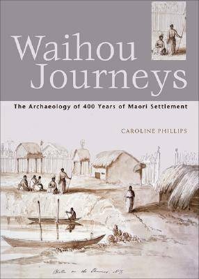
Dr Caroline Phillips - Waihou Journeys (2001)

Wednesday, August 7, 2019

Thames (NZ): Forgotten Roads at Thames - a closer look at Keddell Street

There are an abundance of postcards that showcase the northern end of Pollen Street, the area that today has adopted (and relishes) the heritage nature of their buildings. After all the majority of them are at least 120 years old.

Recently on an online auction site appeared one of these postcards. Taken from the Fire Brigade bell tower, the view shows the Pollen Street shops and the hills to the east above the Waiokaraka School.

Postcard showing Pollen Street (section between Cochrane & Pahau Streets)

Isn't it a beauty? So much to see, the men gathered outside the King's Theatre (opened 1913) are  no doubt curious about the photograph being taken or could be deliberately posed for the shot. 

The Junction Hotel is far right, then working back left, the King's Theatre, J Bate's The Elite Dress Shop, Battson's Plumbing shop, the building with the four curves on the top facade is Wood's Grocery Store. Can you see the Waiokaraka School (Cochrane Street) over the roof of Wood's shop? 

When was the postcard photo taken and when was the postcard sent?  The back of the card is below. The card was written 30 June 1914 and posted to Mrs Church in Canada.


The hidden treasure in the postcard photo is the c1913 view of Keddell Street. To the left of the wording 'Keddell Street' it may just look like a dirt track but that is Keddell Street. Remember many of the streets that were planned on the first maps of the town were either not all constructed, or were shorter than intended.


From the booklet, Streets of Thames:


Above: Far right, Keddell Street runs between Campbell and Princes Street.
Below: The Street marked on Robert Graham's First map of Grahamstown, with Duke and Sophy Street branching off to the right along the length of Keddell Street.


Keddell Street news in the local paper:
1878: The Council decided to cut some steps and a footpath up Keddell Street.
1878: 18th August Mary Ann Connon died at her residence in Keddell Street.
1879: 31st January, William the infant son of Nicholas Dunstan died.
1881: Residents pleaded to the council to improve the state of their street. This is a continuing theme over the years that followed, resident not happy with the state of the road or footpath up Keddell Street.
1891: Mrs Chas Stevens solder her three bedroom house, as she was leaving the colony.
1895: Miss Geary of Keddell Street married John Hatton of Waihi. Later in the year, Miss Geary's father had a bad fall from his horse.
1900: September, poor,little Alf Newdick cut himself badly with a spade, he needed stitches!
1903: The handrails at the side of the footpath leading up Keddell Street were rotten and urgently needed replacement. You could buy a small three bedroomed house on a freehold section in the street for 25 pounds.
1906: Water running down Keddell Street was causing problems during heavy rain, the culvert needed improvements.
1909: The handrail along Keddell Street again needed repair. This is a situation that kept recurring every couple of years.
1911: Mr W Cropp, had approval from Council to make improvements to his house in Keddell Street.
1914: 10 August, water cut off all day for repairs.
1923: Still more repairs to handrails, plus some of the steps up the street.
1930: The 10 foot culvert in Keddell Street was replaced.

In the early 1900s, the residents in the street were:
Mrs Barker, Mrs Bunting, James Neary, P Dewdick (??Newdick), and Barney Donnelly.
By 1923, the two named residents in the Directory were: Henry Brackenridge (a Fitter) and Leslie Thomas White (Blacksmith).

So how does the street look now? As stated above, it took until the 1980s for the road to be formally closed, so now a private driveway winds up the steep hill of old Keddell Street.

Above: The old location of Keddell Street, north of the Waiokaraka Road (visible to the right) 
by the Bella Street Pumphouse.
Source: Google maps